Nestled in Mauritania’s remote Adrar Plateau lies the Richat Structure, known as the Eye of Africa, one of the most striking and enigmatic geological formations on Earth. Spanning around 40 kilometres in diameter, its concentric rings of eroded rock ridges rise from the desert floor, forming a massive bullseye so huge it’s visible from space.
Alongside the Grand Canyon, the Great Barrier Reef, Mount Everest, and the Aurora Borealis, Guelb er Richât – as it’s known locally – is one of planet Earth’s greatest natural wonders, but is it an anomaly that blurs the line between geology and ancient design?
Despite its textbook eroded dome geology, the Richat Structure’s uncanny symmetry has fuelled a fascination which sparks the imagination. Is it purely the work of ancient uplift and relentless erosion over tens of millions of years, or is it the sunken location of Plato’s Atlantis? Bare rock or a lost city? And what secrets does the Eye of the Sahara hold?
Despite speculation and satellite scrutiny, the Eye of Africa remains wide open. Natural or supernatural? Let’s find out.
The Eye Revealed
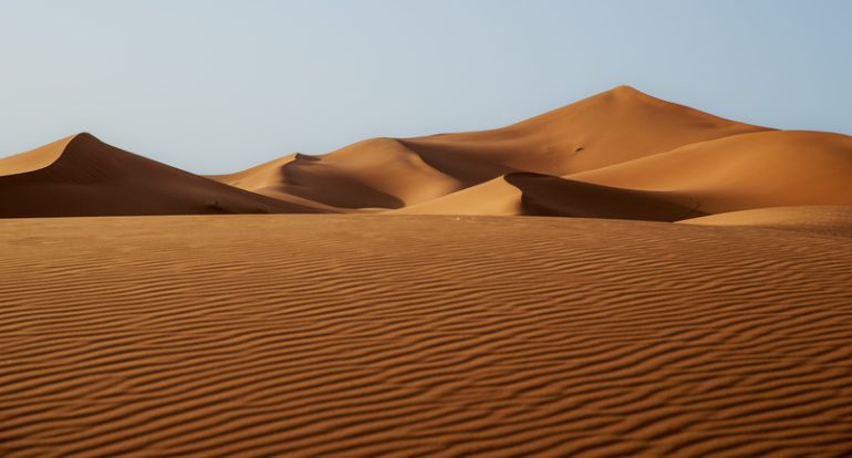
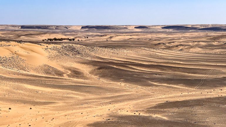
The vast Sahara Desert spans 9.2 million square kilometres (Credit: Massimo Mei via Getty Images)
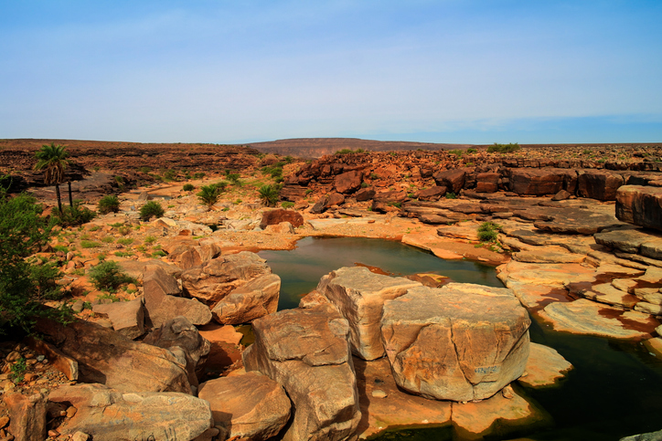
Nestled deep within northwestern Mauritania’s Adrar Plateau, the Richat Structure – better known as the Eye of the Sahara – stares out from the heart of the Sahara, the world’s largest hot desert. This colossal formation is around 40 kilometres across, with concentric rings of rugged rock ridges, reminiscent of ancient amphitheatres, rising from the sands. Stand next to it and it’s impossible to see what it is. Only from far above does the full, hypnotic bullseye emerge, etched into the Earth.
Predominantly dating back around 100 million years to the Cretaceous period with some elements even older, the layered rocks record eons of uplift and erosion, making it a living time capsule of the planet’s past. Locals in the remote Ouadane region have long called the whole feature “Guelb er Richât” – which translates to “Richat Hill” in Hassaniya Arabic. The word ‘guelb’ or ‘qalb’, can also sometimes be translated as ‘heart’ or ‘centre’.
Composed of layered sedimentary rocks, primarily durable quartzite ridges separated by softer valleys of shale and limestone, the dramatic tiers have been sculpted smooth by relentless winds and rare flash floods. At its centre lies igneous rock, which to some, hint at forces from below.
Yet this ancient formation raises fundamental questions about its origins. The precision of its smooth, unbroken rings lack the irregularity of typical eroded domes, so is it solely the product of geological processes, or are there traces of something else?
At First Sight
From ground level, the Richat Structure is impossible to behold (Credit: Louis-Michel DESERT via Getty Images)
For much of human history, the Eye of the Sahara remained effectively invisible – a local landform in a remote corner of Mauritania, far too large to grasp from the ground. It’s believed that World War II pilots used it as a visual reference point, and it was first described in the 1930s and 1940s. It was subsequently detailed scientifically in 1948 by French geographer Jacques Richard-Molard, who called it boutonnière du Richât, or the ‘Richat buttonhole’. In the early 1950s, it was studied by French naturalist Théodore Monod, but without an aerial vantage point, its full form was hard to appreciate or interpret. On foot or by vehicle, it was just another series of ridges and valleys in a harsh desert landscape.
That changed with the launch of the space age. When astronauts began orbiting Earth in the 1960s, the Richat Structure suddenly emerged as a striking landmark. The crew of Gemini IV, James McDivitt and Ed White, captured stunning photographs of the site, as did crews on later Gemini and Apollo missions, as well as more recently by astronauts on the International Space Station. Seen from orbit, the Eye of Africa was no longer an obscure geological oddity. It became a global curiosity, photographed, catalogued, and shared with an international audience.
As satellite imagery improved, detailed photos and measurements spread through scientific publications, atlases, and eventually the internet. What had once been a remote desert circle became a familiar image in textbooks, documentaries, and popular science articles. It was this new, top-down perspective that transformed the Richat Structure into one of the world’s most recognisable, yet puzzling desert formations.
Ancient Inhabitants
Mauritania's Adrar Plateau was once teeming with life (Credit: HomoCosmicos via Getty Images)
The Sahara wasn’t always the barren wasteland it is today. During the African Humid Period, which ended somewhere between 5,000 and 6,000 years ago, this region teemed with lakes, rivers, and grasslands – prime habitat for early humans. While the Guelb er Richât itself sits in a hyper-arid zone today, its surrounding Adrar Plateau preserves traces of prehistoric life, including Acheulean artefacts and Pre-Acheulean stone tools linked to early hominid activity.
From Crater to Complex
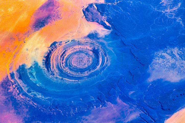
A digitised image of the Richat Structure, photographed from space (Credit: Roberto Machado Noa via Getty Images)
When geologists first examined the Richat Structure, many suspected it was the scar of a huge meteor impact due to its circular shape and central uplift. But as field studies and mapping improved, researchers found no shocked quartz, no high-pressure minerals, and no traces of melted rock – the key hallmarks of an impact event. Instead, the evidence was more benign, it was an uplifted dome of ancient sedimentary rock, later carved into rings by erosion. Other explanations, such as a volcanic caldera or a simple breccia pipe, also failed to match the full range of observations.
Today, the leading view is that the Eye of the Sahara is a deeply eroded, circular geological structure shaped by a combination of uplift, intrusions from below, and tens of millions of years of wind and water wearing it down. At least that’s the explanation offered and accepted by mainstream science, but others have called it ‘the African Atlantis…’
Atlantis in the Sand?

Was Plato's underwater Atlantis in the African desert? (Credit: Panasevich via Getty Images)
Could the so-called Eye of Africa actually be the African Atlantis? Plato, among the most revered of ancient Greek philosophers, wrote about Atlantis around 360 BC. He described a mighty island empire beyond the Pillars of Hercules – generally understood to be the Strait of Gibraltar – with concentric rings of land and water, a central citadel, and a catastrophic sinking around 9,600 BC after a doomed campaign against a fictionalised version of Athens. Proponents of the theory that the Richat Structure is the lost city of Atlantis point to its near-perfect rings resembling Plato’s circular canals, its forty kilometre span fitting a grand metropolis, and its Saharan location aligning with the concept of a once-lush ‘continent’ drowned not by water but by desertification towards the end of the last Ice Age.
Like many unusual theories, the idea that Eye of Africa is the African Atlantis gained traction in podcasts, alternative theory websites and social feeds. Some have even gone as far as mapping Plato’s dimensions onto satellite imagery and citing ancient trade routes. Today such ideas remain popular online but are usually dismissed by archaeologists and geologists as modern internet-era speculation rather than a serious academic hypothesis. Indeed, the site predates humanity by 100 million years, and so far there’s no archaeological evidence of a lost Bronze Age city at the site.
No ruins, artifacts, harbour works, or traces of large-scale human settlement have been found there. In addition, the structure has been inland for millions of years. It was not an island in the Atlantic during the period Plato describes (around 9600 BC). The Sahara was wetter in parts during the early Holocene period, but there’s no geological evidence that the Atlantic Ocean extended anywhere near the Richat area within human history. While comparisons can be made – Plato’s canals as an example – such similarities don’t provide conclusive evidence one way or another.
The Richat Structure: A Sight to Behold
The Richat Structure - sculpted by time and visible from the stars (Credit: Elen11 via Getty Images)
The almost-romantic Atlantis theory of Guelb er Richât certainly captures the imagination, yet so far there’s no real evidence of an ancient city at the site, just ancient captivating rock formations predating humankind. Even if the Eye of the Sahara may not be the lost city of Atlantis, it remains a geological masterpiece – an eroded dome sculpted by deep time, and visible from the stars.