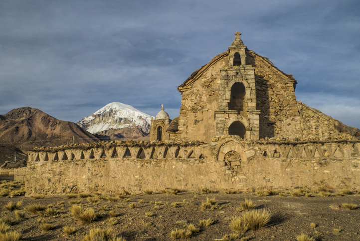
Carved into the high Altiplano of western Bolivia lies the Sajama Lines, one of the largest and most mysterious works of ancient land art ever discovered. Spread across an area of over 22,500 square kilometres, thousands of straight paths criss-cross the dusty landscape beneath the snow-capped summit of Nevado Sajama, forming an immense geometric web fully visible only from above.
Alongside Peru’s legendary Nazca Lines and Paracas Candelabra, and Australia’s Marree Man, these Bolivian mystery lines stand shoulder to shoulder with the world’s most impressive and least understood geoglyphs – an enigma on a monumental scale.
But for all their precision and immense scale, the Sajama Lines’ meaning remains a puzzle. Were they ancient pathways, lines of pilgrimage leading to forgotten shrines? Astronomical markers tracking the stars? Or something otherworldly, created for eyes that watched from above?
So who made the Sajama Lines? Despite decades of research, this colossal Bolivian puzzle remains unsolved. Let’s draw a line through history and see what connects the Sajama mystery.
What are the Sajama Lines?
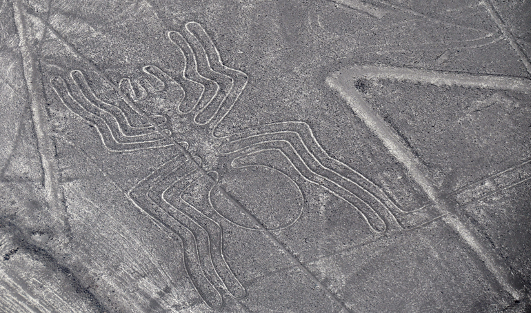
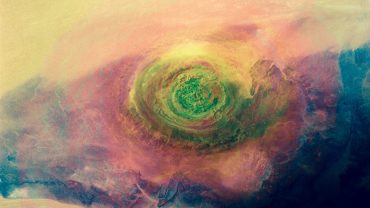
The Nazca Lines depict recognisable shapes, the Sajama Lines are just, lines... (Credit: Thomas Pollin via Getty Images)
High in the Bolivian Altiplano, near the towering peak of Nevado Sajama, lies a vast network of precise, ruler-straight lines carved into the earth. Known as the Sajama Lines, these immense markings cover an area bigger than Slovenia or El Salvador, and roughly the same size as the northeastern US state of New Jersey. The lines in Sajama in Bolivia are truly immense. Geologists and archaeologists still aren’t sure of the true scale of the site, how many lines there are or how far they stretch, but it’s thought there are many thousands, perhaps even tens of thousands, of such lines.
The Sajama Lines themselves were created by scraping away the top surface of vegetation, soil and oxidised rock from the earth to reveal the lighter-coloured material underneath. They range from between one and three metres wide, and satellite imagery reveals just how extraordinary these intersecting routes are, all almost perfectly straight, despite the undulating terrain.
Some of the Sajama Lines are just a few hundred metres long, others stretch up to around twenty kilometres in length. In some areas, there are dense clusters of short segments intersecting and overlapping.
At ground level, they appear deceptively simple, barely visible against the pale desert surface. Yet from above, the staggering scale becomes clear. Countless thousands of lines crisscross the barren plain, forming an intricate web of geometric patterns that seem to radiate from ancient shrines and hilltops.
Archaeological surveys have estimated that if all these Bolivian mystery lines were laid end to end, their total combined length would be around 10,000 miles. That’s roughly the distance from London to Sydney. Or around 40% of the circumference of the Earth. It’s impossible to be precise since many of the Sajama Lines overlap or intersect, and some are eroded or partially buried. But they’re long. Very long.
The Sajama Lines are sometimes compared to Peru’s Nazca Lines, another colossal example of geoglyph art. Yet while the Nazca figures depict recognisable shapes – animals, spirals, and symbols – the Sajama network is pure geometry, vast pathways without pictures.
Who Made the Sajama Lines?
In the shadow of Nevado Sajama (Credit: MisoKnitl via Getty Images)
It’s almost impossible to know with any degree of certainty who actually created the Sajama Lines, but archaeologists believe they were made by the region’s Indigenous peoples long before the rise of the Inca Empire in the 1400s, perhaps more than two thousand years earlier.
The area around Nevado Sajama has been inhabited for thousands of years, most notably by the Aymara and their ancestors, including the Tiwanaku-period communities. These communities are known to have built sacred routes, shrines, and ceremonial spaces across Bolivia’s high plains, suggesting the lines may have been part of a spiritual map or undertaking.
When Were The Sajama Lines Made?
Like the question of ‘who’, the question of ‘when’ is also near-on impossible to determine. The dry, windblown conditions which preserved the Sajama Lines so well also erased organic material that could be radiocarbon dated. Some researchers propose they were made gradually – paths retraced and maintained by generations over centuries – perhaps beginning more than two thousand years ago. Others suggest the Sajama Lines may have been a more coordinated effort, an immense communal project guided by religious or astronomical significance.
What’s clear is that whoever built them had extraordinary skill and a profound sense of direction. Without modern tools, they carved perfectly straight lines across uneven ground and over hills, guided only by sight and memory.
Sajama Lines Theories: Pathways or Messages?
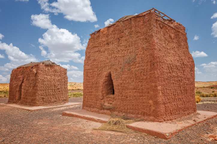
Did the Sajama Lines link these burial towers in the high Altiplano? (Credit: jarcosa via Getty Images)
Over the years, scholars, explorers, and even mystics have proposed countless explanations for the Sajama Lines’ meaning. One of the earliest, albeit brief, references to the Sajama Lines in English was in the early 1930s from Swiss-born Argentine professor Aimé Felix Tschiffely. Later that same decade, they were brought to scholarly attention by Swiss anthropologist Alfred Metraux who published ethnographic fieldwork of the Aymara and Chipaya people who inhabited – and continue to inhabit – the region.
The most widely accepted theory is that they formed a vast network of ceremonial pathways, linking ancient shrines (wak’as), burial towers (chullpas), and sacred mountains known as apus. Pilgrims may have walked these routes during religious rituals, their footsteps slowly engraving straight tracks into the barren soil over generations. In this view, the Sajama Lines are a lifesized geographic map.
Others believe the lines served a more functional purpose, perhaps a system of routes connecting remote settlements, or a kind of cartographic plan aligning with celestial bodies. The precision of their orientation has led some to wonder whether they tracked solstices, star positions, or even rainfall patterns on the high Altiplano.
Then there are the more speculative ideas, fuel for documentaries, podcasts and late-night theories. Some suggest they might be signals to the gods, messages visible only from the heavens – or by extraterrestrial visitors. Yet despite the array of hypotheses, none can be proven. Like their creators, the meaning of the Sajama Lines and true purpose has been lost to history, and what’s left is loud silence and exquisite geometry.
Etched in Mystery: The Sajama Lines
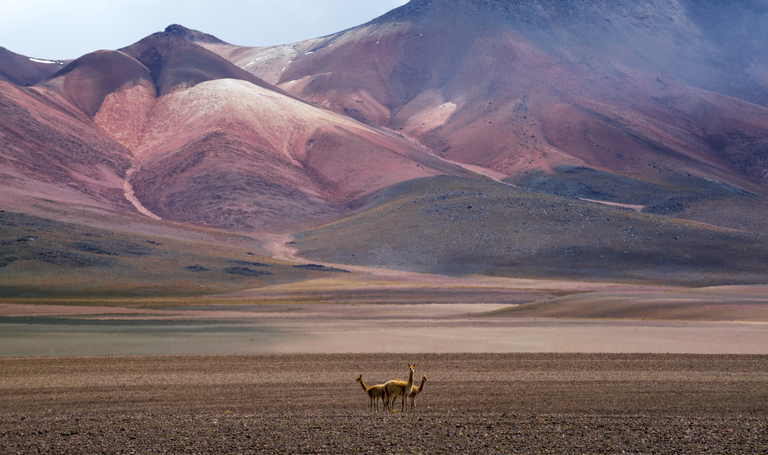
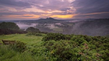
What secrets does the Bolivian Altiplano hold? (Credit: Ignacio Palacios via Getty Images)
Carved into Bolivia’s windswept Altiplano, the Sajama Lines remain enigmatically silent. Centuries of erosion have barely dimmed their precision, but their purpose is elusive – part pilgrimage route, part celestial map, part perplexing mystery.