Piri Reis was no ordinary cartographer, and his map is no ordinary map. Believed to have been created in 1513, not only does it challenge our understanding of historical navigation and cartography, but also the chronology of global exploration. At the heart of this mystery is a seemingly impossible depiction. Antarctica without ice.
Perhaps more astonishingly, he also directly references the use of maps charted by Christopher Columbus. However, today, none of Columbus’s maps survive. Does the Piri Reis map give us a unique insight into the work of Columbus? Work of staggering historical importance that was deemed to have been lost forever?
The mystery of Piri Reis, 1513 cartographer extraordinaire, is one that has left the world baffled since his creation was discovered. Let’s dive into the intriguing world of the sixteenth century Ottoman Empire as we attempt to shed light on one of the world’s most perplexing mysteries.
Who was Piri Reis?
Born on the Gallipoli peninsula in modern-day Turkey likely between 1465 and 1470, Hacı Ahmed Muhiddin Piri was a career sailor who followed in the footsteps of his uncle, the famous sailor Kemal Reis.
He sailed alongside his uncle on numerous expeditions in the Mediterranean Sea, confronting Spanish and Venetian naval forces. These expeditions provided him with experience in naval warfare, navigation, and reconnaissance. After the death of Kemal Reis in 1511, Piri Reis began to focus more on his passion for cartography, though he remained an active figure in the Ottoman navy. Reis was a military rank similar in equivalency to a captain, and he eventually rose to the rank of admiral.
The Piri Reis book, Kitāb-ı Baḥrīye, known as the Book of Bahriye, or The Book of the Sea stands as one of the most renowned cartographic masterpieces of its era. Providing mariners with insights into the Mediterranean’s coastline, islands, channels, straits, and bays, the book offers guidance on safe havens during storms, methods to navigate into harbours, and exact pathways to various ports.
He’s also said to have been the creator of one of the most astonishing maps ever produced. One that raises a number of the world’s most curiously captivating cartographical conundrums.
The Piri Reis Map

The Piri Reis world map, 1513. Artist: Piri Reis (1470-1553) (Credit: Fine Art Images/Heritage Images via Getty Images)
In 1929, while cataloguing maps belonging to Ottoman Sultan Mehmed II at Istanbul’s famous Topkapı Palace, German theologian Gustav Deissmann found a bundle of long-forgotten parchments. Among them was one so unusual it warranted further research. The document immediately attracted attention due to its apparent depiction of parts of the Americas and, perhaps, the portrayal of an ice-free Antarctica.
However, the 87 cm x 63 cm map that was discovered is not complete. The extant section of the Piri Reis 1513 map represents roughly one-third of the original, which would probably have shown the entire world as known in the early sixteenth century. From what remains, portions of the Atlantic Ocean, Europe, Africa, and the Americas are visible. However, large sections, particularly the eastern portions which would likely have depicted Asia and probably more, are missing.
As a senior and highly-regarded member of the Ottoman Empire’s maritime community, Piri Reis had access to an array of maps from various civilisations, from the Islamic Golden Age to remnants of cartographic efforts from antiquity. It’s also said that he may even have used a map supposedly found in the Library of Alexandria – dating back over 2,000 years – as well as another map drawn by Christopher Columbus himself. Neither of which have survived.
Yet, the outcome was not just a reversioning of known knowledge; it was a projection that appeared years ahead of its time.
The Mysterious Masterpiece
The map itself is a staggeringly beautiful and intricately detailed nautical chart called a portolan chart. Unlike the Piri Reis book, known as the Book of Bahriye, it includes compass roses and is extensively notated in Ottoman Turkish. It depicts the Iberian Peninsula and the western coast of North Africa. It displays a detailed stretch of the eastern coastline of South America, starting from modern-day Brazil and extending southward, as well as some Caribbean islands, most notably the northern part of the South American coastline.
But the most intriguing element of the map, and one that has baffled cartographers, geographers and academics for almost a century is the mysterious southern landmass.
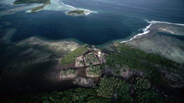
There’s a section that some speculate depicts the northernmost part of Antarctica without its ice cover, a depiction only possible today thanks to advanced satellite imagery. However, this interpretation remains debated among scholars. Some think it could be a misrepresentation or a continuation of the South American coast, while others believe it might indeed hint at a time when Antarctica was ice-free.
Based on modern techniques, these depictions appear to have been derived from times before certain glaciers formed. This suggests that some of Piri Reis’ sources might have been based on very ancient geographical knowledge, though the notion of it predating the last major ice age is highly speculative.
Did Piri Reis Draw Antarctica?
The answer, it seems, is inconclusive. If he did, the most obvious question requiring an answer is how did he even know about Antarctica given that the ice shelves weren’t seen until the 1820s, some three centuries later? Secondly, if it indeed is Antarctica, how could it have been depicted without a covering of ice? There are a number of prevailing theories, ranging from the scientific to the speculative.
Misinterpretation of the Coastline
One of the more conservative theories suggests that the landmass depicted isn’t Antarctica at all, but rather a distorted or mistaken representation of the coastline of South America. The jagged, intricate depiction of the southern section of the map could potentially be the result of Admiral Reis combining or misinterpreting various source maps.
Use of Ancient Source Maps
Some proponents of the idea that it shows Antarctica believe that Piri Reis may have had access to ancient maps from lost civilisations or from eras before recorded history. They suggest that these maps might have shown the world in different climatic conditions, possibly from a time when Antarctica was ice-free.
Cartographic Speculation
Some cartographers of the time speculated or extrapolated landmasses based on limited data, sometimes filling in gaps with educated guesses. The Piri Reis 1513 map used multiple sources, and it’s conceivable that at least one of those sources contained speculative geography.

Read More About: Mysteries
The Mystery of the Devil’s Footprints
Elaborate Forgery
While the authenticity of the Piri Reis map itself isn’t typically in question, some have nevertheless suggested the idea of forgery or later modifications. However, there’s currently no definitive evidence to support this theory, and the map’s discovery in the Topkapı Palace and its well-documented provenance make forgery an unlikely explanation.
Seafloor Topography
Another interesting, although wildly speculative, suggestion is that the map doesn’t depict the actual coast of an ice-free Antarctica but rather its seafloor topography. This would mean that ancient mariners had a way of detecting underwater landmass shapes, a highly unlikely but intriguing proposition.
Coincidence
Given that map-making and cartography, especially in the sixteenth century, had a margin of error and involved some artistic licence, some believe that any resemblance to an ice-free Antarctica is merely coincidental and not intentional.
It’s also worth noting that the official discovery of Antarctica in the 1820s doesn’t preclude the possibility that earlier explorers stumbled upon the landmass but lacked the means or intent to announce it to the wider world. Still, this theory, like others, remains speculative.
Charting the Uncharted: The Piri Reis Enigma
The Piri Reis book was, and remains, a celebrated work, but since it was discovered in 1929, his map has sparked intrigue and fascinating debate.
This centuries-old document is not merely a testament to the prowess of early sixteenth century navigation and map-making, but it stands as a profound enigma, challenging our understanding of historical knowledge and the evolution of world geography.
Admiral Reis’s purported depiction of regions like an ice-free Antarctica, centuries before its official discovery, beckons scholars, historians, and enthusiasts to delve deeper, question further, and speculate on the very nature of ancient knowledge.
Must Read
Were there lost sources, forgotten explorations, or ancient civilisations with advanced cartographic knowledge in the Piri Reis book or map? Or do we see artistic interpretations, mistakes, or mere coincidences that have been misread over time?
While definitive answers remain elusive, the Piri Reis 1513 map serves as a potent reminder of the mysteries that still lurk within history’s shadows. It underscores the enduring quest for understanding the world, its landscapes, and the evolving craft of mapping it – a quest that has spanned millennia and promises to continue for many years to come.